If you live anywhere near the Great Lakes you already know that winter can flip from calm to chaos in minutes. One minute you are driving under blue skies and a mile down the road you can barely see your hood because a wall of snow just swallowed everything. That sudden shift is usually tied to lake effect snow and when conditions get intense enough the National Weather Service issues a lake effect snow warning to alert people of dangerous weather.
Here is the thing. Lake effect snow is different from a regular winter storm. It is unpredictable localized and capable of dumping extreme amounts of snow in a very short period of time. So if you hear this warning you are not just dealing with a normal winter day. You are dealing with something that can shut down highways trap drivers and put people at serious risk if they are unprepared.
Snippet-Ready Definition
A lake effect snow warning alerts people that heavy localized snow from large lakes will create dangerous travel and low visibility. It helps communities prepare for fast changing winter weather conditions.
What Is Lake Effect Snow
Lake effect snow develops when cold dry air rushes over warmer lake water. The water heats and moisturizes the air which then rises cools and dumps heavy snow on the downwind side of the lake. This process can create narrow but powerful snow bands that sit over the same towns for hours sometimes days.
If you have ever seen snow in Buffalo Erie or northern Michigan pile up faster than you can shovel that is the power of lake effect snow. What makes it tricky is that conditions can change street by street. You might get a dusting at your house but your cousin a few miles away could be digging out from two feet of snow.
How Lake Effect Snow Is Different From Regular Snowstorms
Regular winter storms come from large weather systems that spread snow over wide areas. Lake effect snow is hyperlocal. It targets communities directly downwind of lakes and produces extreme snow rates sometimes more than two inches an hour. On top of that wind gusts can create whiteout conditions even if snowfall totals are not massive which is why travel becomes dangerous fast.
Quick Guide Table: Warnings vs Advisories vs Winter Storms
| Alert Type | What It Means | Risk Level | What You Should Do |
| Lake Effect Snow Warning | Intense localized snow from lakes with whiteouts and fast accumulation | High | Delay travel stay informed prepare for power issues |
| Winter Storm Warning | Widespread storm with heavy snow wind or ice | High | Avoid travel stock supplies follow updates |
| Winter Weather Advisory | Moderate winter conditions causing inconvenience | Moderate | Drive carefully watch roads allow extra time |
Where Does Lake Effect Snow Occur
Lake effect snow usually strikes communities around the Great Lakes including New York Pennsylvania Ohio Michigan and Ontario. Some of the most intense events hit western New York especially places like Buffalo and Erie County. Michigan also sees repeated events especially along Lake Michigan where wind direction lines up perfectly to dump snow along shoreline towns.
A lot of people do not realize that lake effect snow also happens outside the United States. It occurs near the Great Salt Lake in Utah and in other countries with large inland lakes like Japan or areas near the Baltic Sea. But the Great Lakes region still takes the crown for both frequency and intensity.
Understanding Lake Effect Snow Maps And Snowbelt Zones
If you look at a lake effect snow map during an event you will see narrow color bands showing where the heaviest snow is expected. These are called snow belts. They are predictable but only to a point because even a slight shift in wind direction can move a snow band several miles. Residents in snowbelt zones know the drill. They often prepare early because they understand how fast conditions can go from annoying to dangerous.
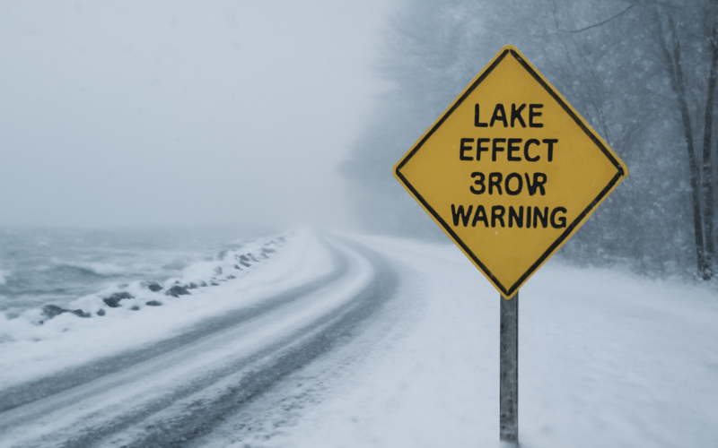
What Is A Lake Effect Snow Warning
A lake effect snow warning is issued by the National Weather Service when heavy lake effect snow is expected along with dangerous travel low visibility and potentially life threatening conditions. These warnings are based on expected snowfall rates duration and how likely it is that the same areas will get repeatedly hit.
People sometimes confuse this with a winter storm warning but they are not the same. A winter storm warning covers large weather systems often involving snow sleet or ice. A lake effect snow warning is hyper focused on heavy localized snow caused directly by lake interactions.
Lake Effect Snow Warning vs Winter Storm Warning vs Advisory
Here is a simple difference
- Lake Effect Snow Warning: Heavy localized snowfall often intense and unpredictable
- Winter Storm Warning: Wide area storm involving snow ice or strong winds
- Winter Weather Advisory: Lower level event where conditions are still disruptive but not extreme
If you hear a warning instead of an advisory that is your sign to take it seriously not just hope for the best.
Why Is Lake Effect Snow So Bad
Lake effect snow is bad because it comes down fast often more than two inches per hour with powerful winds that turn highways into ice sheets. Visibility can go from clear to zero in seconds. This is why drivers get stuck why pileups happen and why local authorities sometimes issue travel bans.
Here is another problem. The storms can sit over the same town for hours so snow does not just fall. It accumulates into towering snowdrifts that block roads bury cars and collapse roofs. When you combine heavy snow freezing temperatures and strong winds you get a dangerous combination that challenges emergency services.
What Does Lake Effect Snow Look Like In Real Life And On Radar
In person it looks like a solid wall of snow moving toward you. You might be able to see it forming miles away because it is so dense and defined. On radar it shows up as long narrow bands often stretching directly downwind of a lake. If you are inside that band visibility will drop fast and conditions will feel chaotic even though nearby towns are barely affected.
What Weather Conditions Trigger A Lake Effect Snow Warning
Lake effect snow depends on five main ingredients
- Cold air passing over relatively warm lake water
- Enough distance over open water for air to pick up moisture
- Wind direction that lines up snow bands over specific towns
- Minimal lake ice which allows evaporation
- Hills or higher terrain which intensify snowfall
If you live in a snowbelt you probably notice the pattern. As soon as cold air settles over unfrozen lakes and winds turn from the west or northwest you know trouble is coming.
From Lake Effect Rain To Lake Effect Ice And Snow
During fall you may see lake effect rain before temperatures drop low enough for snow. As winter settles in those same systems transform into heavy snow. Later in the season as lakes freeze snow output decreases. Ice acts like a lid reducing moisture transfer and weakening storms.
What To Do When A Lake Effect Snow Warning Is Issued Today
If you get this warning do not assume regular winter conditions. Prepare for hazardous travel long delays and potential disruptions to power and services. You will want to think ahead not react when it is too late.
Home And Family Safety Checklist
Keep items like
- Food water and essential medications
- Flashlights batteries and backup heat sources
- Fully charged phones and portable chargers
- Thermal blankets and warm clothing
The best part is preparing early means you can stay comfortable at home instead of fighting crowds later.
Vehicle And Travel Safety Tips
If you can postpone travel do it. If not carry
- Warm clothing and blankets
- Shovel and traction material
- Phone charger and food
- First aid supplies
I have responded to many storms where stranded drivers told me they thought they could outrun the snow. Trust me you cannot outrun a snow band.
Power Heat And Staying Warm
Lake effect events can last for days. Stock safe heat sources and never run a generator inside a garage or house. Carbon monoxide kills every winter because people panic when heat goes out. Good planning prevents dangerous mistakes.
Real World Examples From Buffalo Michigan And Other Hotspots
Buffalo has seen some of the most extreme snowfalls in US history including multiple multi foot events that shut down highways and triggered travel bans. Michigan has entire towns that spend weeks under repeated snow bands that dump snow faster than plows can clear.
These are not random freak events. They happen because geography wind and lake temperature create perfect conditions for snow production year after year.
How To Track Lake Effect Snow Maps Radar And Alert Tools
Reliable information can save lives. Use tools like
- National Weather Service alerts
- NOAA weather radar
- Local TV weather
- Smartphone apps with real time updates
Here is the thing. Conditions can change in minutes. So check updates often and rely on official sources not social media rumors.
How Long Does A Lake Effect Snow Warning Last
Warnings usually run for 6 to 24 hours but storms can shift constantly. The warning might get extended cancelled or upgraded depending on wind temperature and lake conditions. You cannot judge safety by looking out the window because a snow band can shift into your town unexpectedly.
Conclusion
Lake effect snow warnings are not just routine winter alerts. They are serious safety signals for people who live near large lakes and face intense localized snow events. Understanding how lake effect snow works where it happens and how to prepare gives you a major advantage when the next warning arrives.
The smartest approach is simple. Stay informed prepare early and respect the warning even if conditions look calm at the moment. Weather around the Great Lakes can change faster than you expect and being ready before things fall apart is always easier than trying to recover afterward.
FAQs
Q1: What triggers a lake effect snow warning
A warning is issued when intense localized snowfall from lakes is expected to create hazardous travel low visibility and dangerous conditions in affected areas.
Q2: Why does lake effect snow hit some towns harder than others
Wind direction aims snow bands at specific communities often the same towns every winter because of geographic position near large lakes.
Q3: How long does a lake effect snow warning last
It can last 6 to 24 hours or more depending on wind moisture and temperature. Conditions may shift quickly even if they look calm at the moment.
Q4: Is lake effect snow worse than a regular snowstorm
It can be. Lake effect snow falls faster with stronger wind and sudden whiteouts that make driving extremely dangerous in a short amount of time.
Q5: How can I tell if I’m inside a snow band
Check radar maps or weather apps. Look for narrow streaks directly over your region. Conditions inside bands change much faster than surrounding areas.
Disclaimer
This article is for general educational purposes and is not a substitute for official weather alerts or emergency instructions. Always follow guidance from local authorities the National Weather Service and emergency management professionals during severe weather events.